Valdaveto.net
Val d'Aveto official website
Valdaveto.net > Itinerari, sentieri, escursioni e ciaspolate > The Alta Via dei Monti Liguri through Val d'Aveto
The Alta Via dei Monti Liguri through Val d'Aveto
Sandro Sbarbaro
by Sandro Sbarbaro (versione italiana: L'Alta Via dei Monti Liguri)
English translation by Maura Rocco

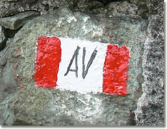
After Passo della Scoffera and Monte Lavagnola, the route of the Alta Via dei Monti Liguri ![]() reaches Barbagelata (1115 m , 3658 ft), descends towards Passo della Scoglina (940 m , 3083 ft), and goes up again in the direction of Monte Poggio Grosso and then goes on to Passo dei Pozzarelli.
reaches Barbagelata (1115 m , 3658 ft), descends towards Passo della Scoglina (940 m , 3083 ft), and goes up again in the direction of Monte Poggio Grosso and then goes on to Passo dei Pozzarelli.
Around 1713 Passo dei Pozzarelli, Passo Rondanara and Passo Ventarola 
were the best-known approach routes to Val d'Aveto arriving from Val Fontanabuona.
The Alta Via dei Monti Liguri then goes up again towards Monte Camolaio and, past Passo d'Arena, it goes on to Bricco della Scavizzola and reaches Monte Pagliaro, which is a wonderful landscape between Valle dell'Aveto and Val Fontanabuona.
In 1725 cartographer Matteo Vinzoni regarded Monte Pagliaro as one of the most important lookout points while he was drawing his map of the Capitaneato of Rapallo. He was asked to draw up the map by the authorities of Genoa in order to settle a controversy about boundaries between the Marchesato of Santo Stefano d'Aveto and the Capitaneato of Rapallo, and especially between the parishioners of Priosa d'Aveto and those of Arena di Fontanabuona.

Going past Monte Pagliaro you reach Monte Roncazi, Monte Rondanara and then Passo Rondanara, which leads to Val d'Aveto (to Isoletta) when coming from Lorsica.
A short downward slope goes to Passo di Ventarola, once crossed by caravans of mules arriving from the Italian Riviera: they crossed Passo del Dente coming from Val di Sturla or they went through Orero di Fontanabuona if coming from Recco or from Rapallo.
In the XVI century highwaymen controlled Passo di Ventarola and merchants going to Piacenza had to pay some "protection money" for their goods.
After Bocca di Feia you reach Monte Ramaceto (1345 m , 4412 ft), which is a natural amphitheatre, a thrilling scene with the course of the river Aveto, Valle Sturla, Val Fontanabuona and Golfo del Tigullio.
From Monte Ramaceto you go down to Passo della Crocetta and Passo della Colletta, and then you reach Passo della Forcella (or Madonna della Neve) where you find the carriage road going to Rezzoaglio coming from Borzonasca. This carriage road, in this case coming from Favale di Malvaro, is the same one you find along the Alta Via dei Monti Liguri at Passo della Scoglina.
Past Passo della Forcella, the Alta Via dei Monti Liguri goes on towards Foresta delle Lame, along the southern side of Rezzoaglio, goes up again to Monte Bozale and then it descends to Passo Bozale.
Here, built on one of the most trodden routes since the monks from Villa Cella reclaimed the marshy lake of Piana di Cabanne, you find a small chapel, which is also a refuge.

Going past Passo Bozale you find Passo delle Rocche, or Passo di Bisinella, one of the main approach routes to Val d'Aveto from Val di Sturla at the time when the monks of Villa Cella spread the word of God.
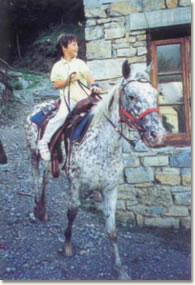
The medieval route has partly been restored to open La via dei monaci di Pietramartina, where you can either walk or go on horseback. It starts from Chiavari and reaches Borzonasca, and then it goes up to Bozale, reaches Villa Cella and, past the wonderful Costafigara, it ends up at Rezzoaglio.
Past Passo delle Rocche, the Alta Via dei Monti Liguri goes on towards Passo delle Lame (1300 m , 4265 ft) and Passo di Pre de Lame, leaving south Monte degli Abeti (1534 m , 5032 ft) and north the small lakes of the Riserva Naturale delle Agoraie. In this area you find Lago degli Abeti that always sparks tourists' interest thanks to the millenary logs found at the bottom of the lake and the many rare botanical species you may find here.
Passo di Pre de Lame was once used, towards Val di Sturla, both by people walking the route between Rezzoaglio and Magnasco and by people walking along the route from Villanoce to Cerisola.
Then Alta Via dei Monti Liguri goes on to Aiona, Passo della Spingarda, Monte Nero and Passo dell'Incisa (1392 m , 4566 ft).
Not too far from here you find Monte Penna (1735 m , 5692 ft).
Links
- www.altaviadeimontiliguri.it > The route of the Alta Via dei Monti Liguri

- When Hemingway crossed 'Valle degli dei'
- Short stories about emigrants
- Poesia e traduzione, l'incontro impossibile?
- Quando Hemingway attravers˛ la 'Valle degli dei'
- L'Alta Via dei Monti Liguri
- Il territorio della Val d'Aveto: suddivisione per parrocchie
- Panorami della Val d'Aveto
Pagina pubblicata il 6 gennaio 2005
(ultima modifica: 09.07.2014), letta 8756 volte dal 23 gennaio 2006
